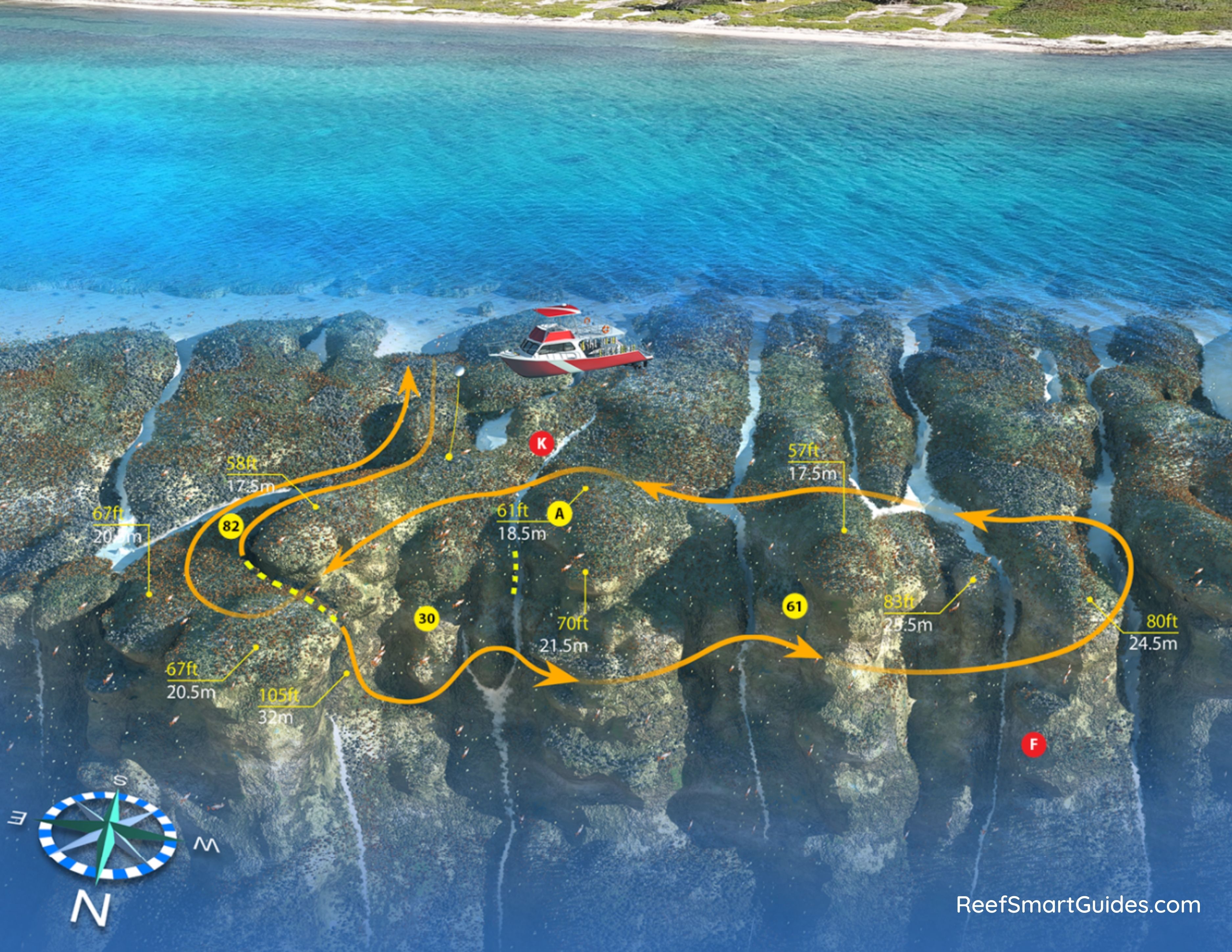
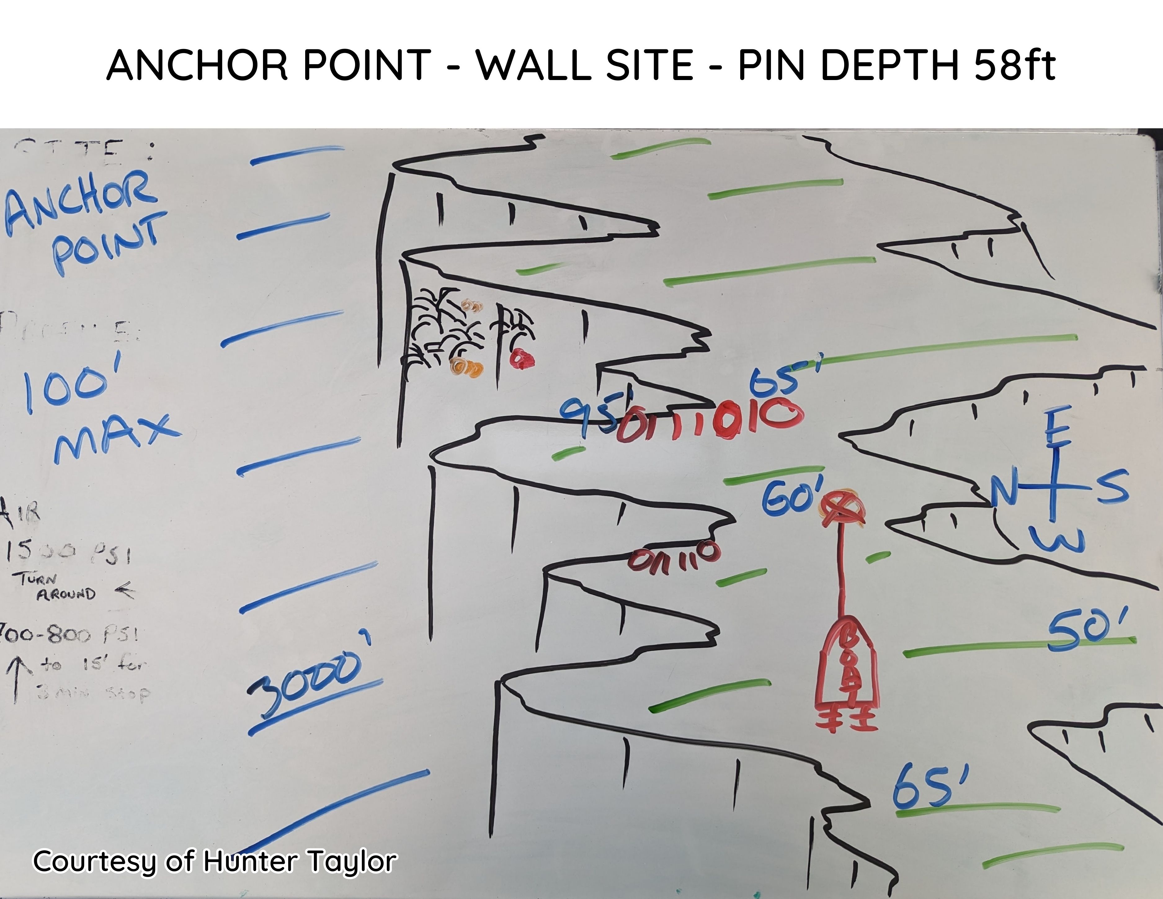
Anchor Point
East End - Queen's Highway Anchor Point
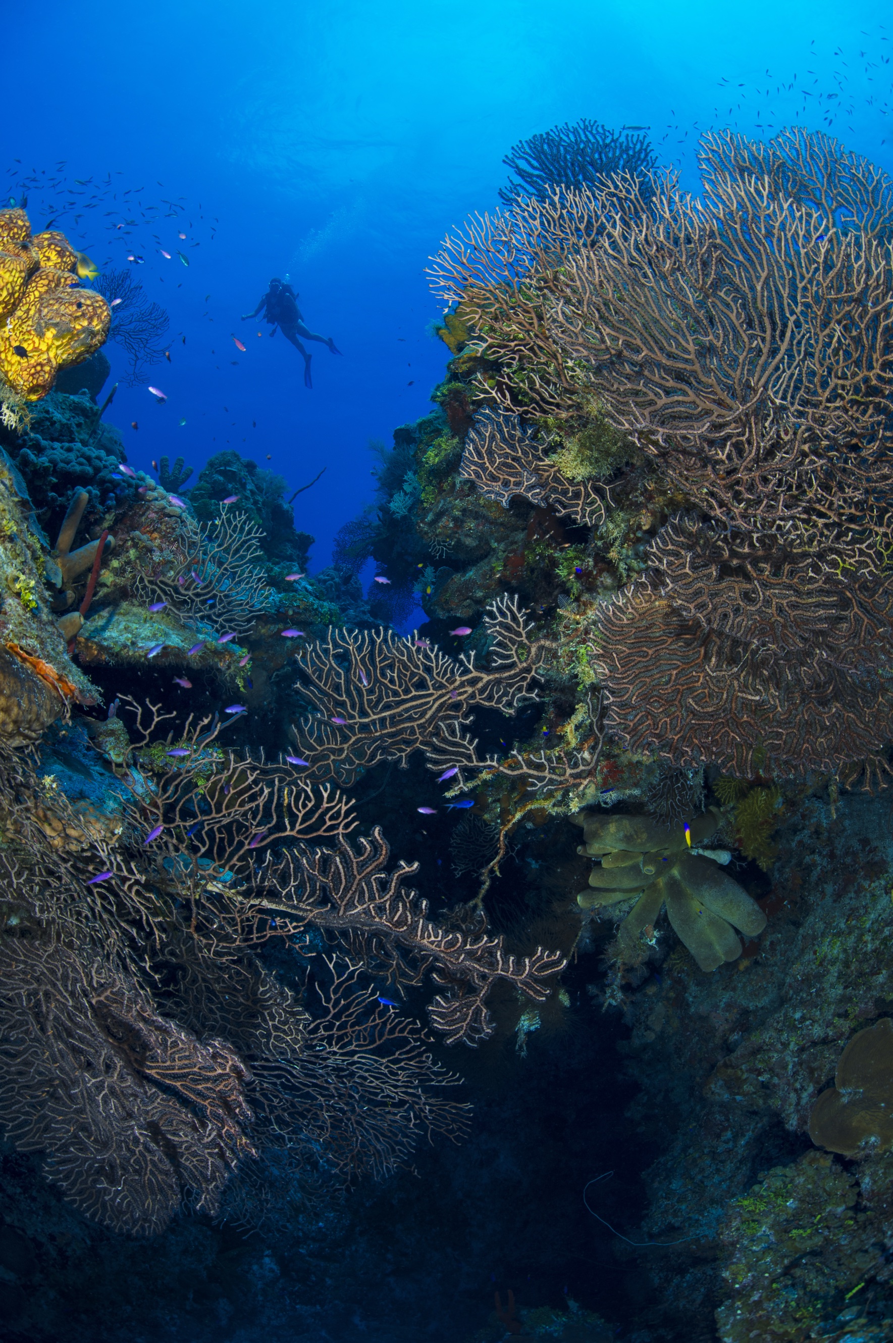
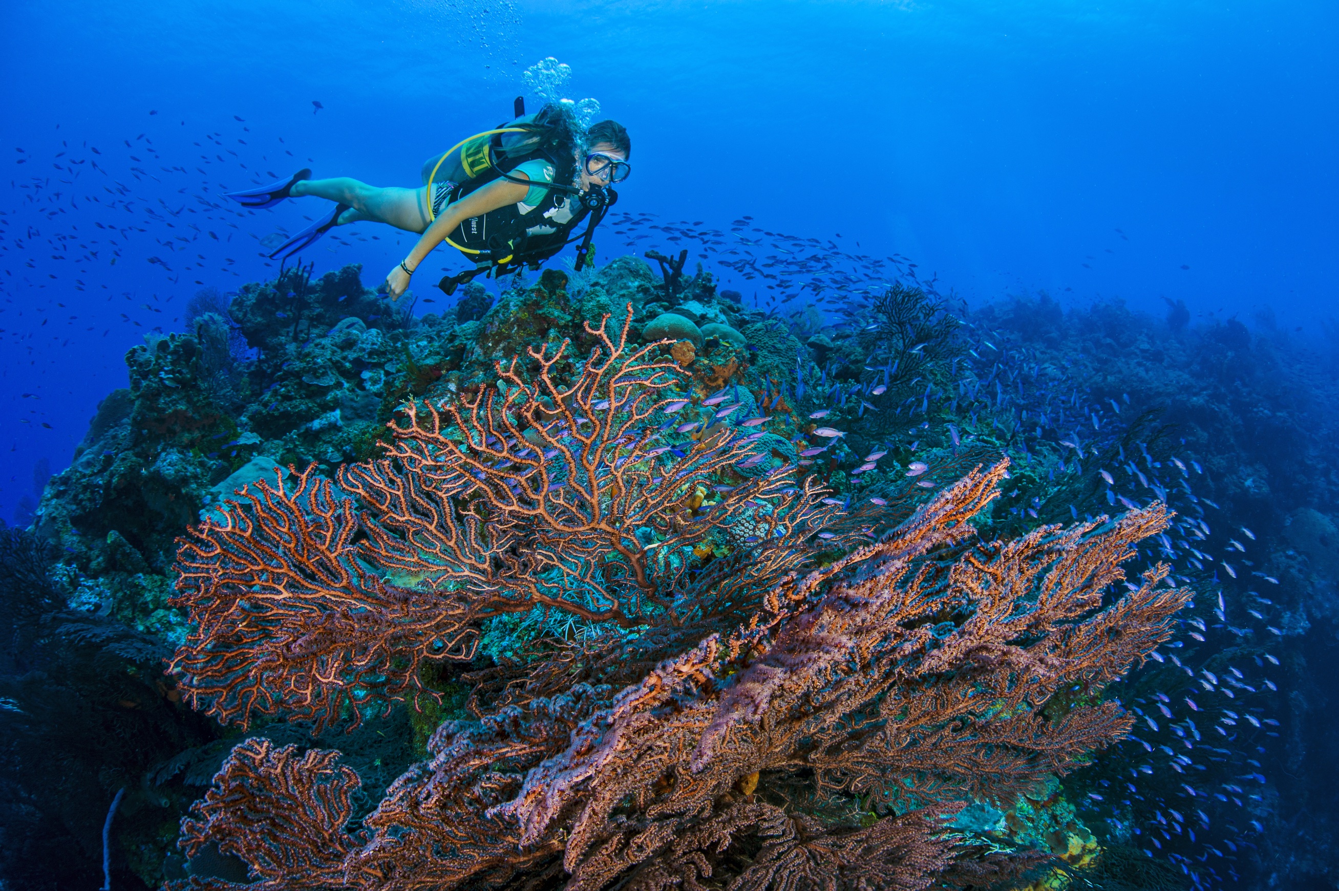
Anchor Point sits in front of Barefoot Beach, a rare low-lying beach on the northeastern coastline, and takes its name from old maritime charts that marked this partially sheltered cove as an ideal anchorage during the early settlement of the Cayman Islands. The dive begins with a relatively easy yet thrilling swim-through leading directly onto the wall. The roof of the swim-through is a gradually narrowing cone with a crack at the top that allows constant light inside, making it comfortable even for those who prefer not to dive in darkness. Look up for Sea Plumes as you pass through — they resemble snow-covered fir trees.
Heading west from the exit brings divers to a series of closely spaced headlands and valleys with small ledges covered in fish life. Blue and Brown Chromis hover near the drop-off on these little ledges, while the north wall is one of the best places on East End to spot turtles. Look for both the Hawksbill — identified by its overlapping beak and muted brown shell — and its rarer cousin, the Green Turtle, which is noticeably greener with flush-sitting shell plates and a rounder face.