 For a better experience on Ocean Frontiers, Update Your Browser.
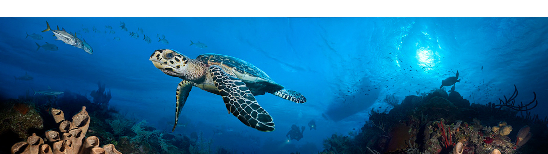
12-Mile Banks Expedition
- James Snelgrove
- October 31st 2020

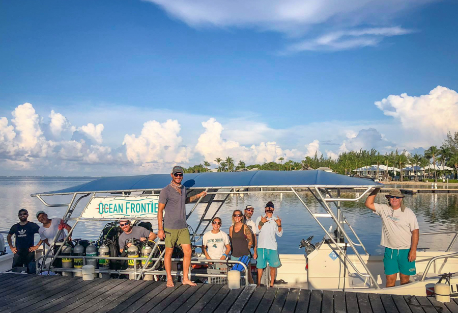
At the beginning of September 2020, a group of staff from Ocean Frontiers headed to an offshore seamount called Twelve Mile Banks to find a wreck that hadn’t been dived for over 17 years. We needed to verify it’s whereabouts and condition before taking paying customers there the following Sunday.
This is my account of the search and the eventual discovery of the shipwreck, and then the trip we ran through Ocean Frontiers for our customers.
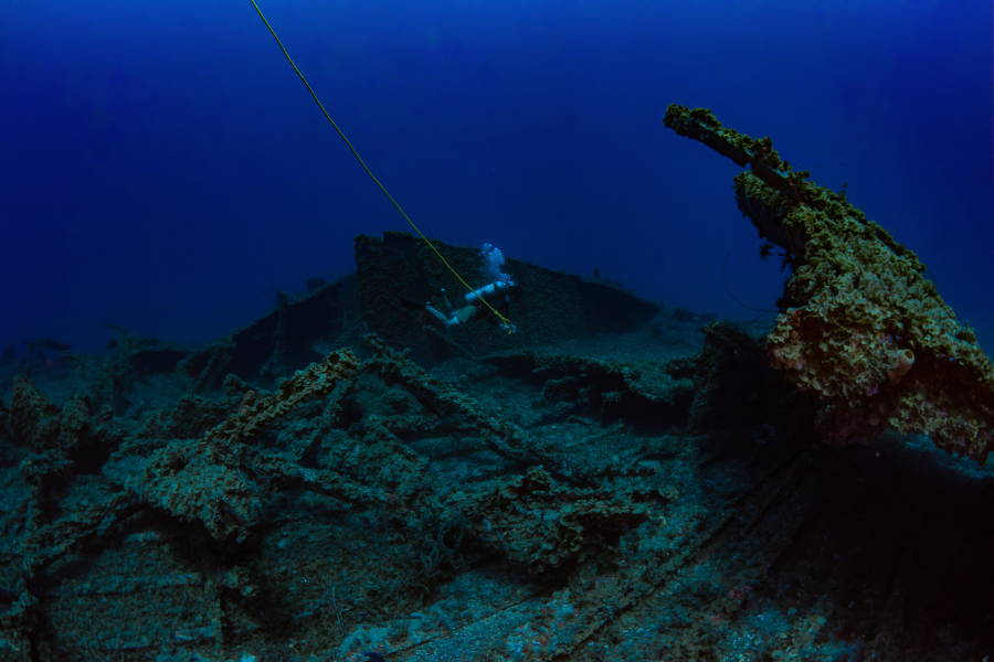
After an easy ride out on a glassy-flat sea, we suited up and prepared to get into the water. It was a simple brief – just look down and you will able to see a 250-foot long wreck below you, but it would soon become apparent that our easy morning of diving would turn into anything but. The wreck we were looking for is known simply as ‘The Fuel Barge’.
Back in the 1980s, this behemoth was being towed down to South America across the Caribbean. During its journey, it was dragged into Georgetown harbour, Cayman Islands, in a sorry state and taking on water. The tugboat captains responsible for its passage south had major concerns knowing that it was on death’s door. A few phone calls to the owner later, it was considered a write-off and everyone knew it was only a matter of time before it sunk into Neptune’s realm. The Cayman Islands government wanted it gone ASAP because it would be a shipping obstruction if it sank in the harbour. The local dive community suggested it should be sunk offshore to become a dive site. They wanted it on an undersea mount that comes to within 100 feet of the surface – Twelve Mile Banks – the Cayman Islands’ lost ‘fourth island.’
The only issue came when, after the sinking, a boatload of divers went looking for their new wreck full of questions; ‘Did it sink upright? Did it break up upon landing on the seabed? How long until the marine life moves in?’ Unfortunately for them, however, that due to the unreliable nature of LORAN (a precursor to GPS based on radio waves), the wreck was nowhere to be found. Even after numerous dives, scans of the seabed, and even aerial searches, the wreck was lost. It remained so until fifteen years later when a small group of divers from Ocean Frontiers on the East End happened across it in 1997; during the safety stop at the end of a drift dive, they noticed an ominous shadow below them made up of the sharp right-angles and the razor straight lines that are not present in nature. There is no mistaking a manmade object underwater, swallowed by the ocean.
After its discovery, Ocean Frontiers continued to dive the wreck for the next few years until 2004 – a year that is stamped firmly in the collective memory of the Cayman Islands. Hurricane Ivan. A category five mega-storm that whirled its way through this peaceful Caribbean paradise in early September, its eyewall just a few miles offshore to the south, and sustained wind speeds of over 185 miles an hour. The island was decimated. Storms of this nature can easily move shipwrecks. One only needs to consider Hurricane Nate in 2017, which flipped the ex-USS Kittiwake onto its side and moved it 50 yards to the south, pushing it up against the reef wall; even more impressive when you factor in that Hurricane Nate was hundreds of miles away! For those of us not here during Ivan, we can only imagine the force that it must have exerted; for those who were on the island though – there is no need to imagine.
When several dive groups went to visit the fuel barge wreck in the years after the hurricane, they always came up with nothing. It seemed that with each trip undertaken to find it, the divers always came back disappointed. The GPS co-ordinates slowly began to become diluted and forgotten, spoken in hushed tones, and hastily scribbled onto napkins in bars across the island – the ink smudged, and the true location lost to the sands of time. Slowly but surely the wreck once again had vanished.
So, this is where our little motley crew found ourselves mid-morning 17 years later, on a September’s day in 2020. Each time the snorkellers entered the water in the vicinity of the GPS numbers all they could see was the faint outline of sand channels and coral mounds below – none of the right angles or straight lines that would betray a wreck in sight. Time and time again, we took turns jumping in the water whenever a blip was detected on the depth sounder, and each time there was nothing but featureless rock and reef in all directions.
Morning turned to afternoon, and after miles of snorkelling and fruitless hours staring at the depth sounder, we were about to give in. Luckily, on the final survey dive of the day, we spotted what we feared divers would never see again – the wreck. Seventeen years of storms had taken their toll, and the once intact barge was a mess of jagged metal, sharp edges, and gloomy recesses. During the journey home, we double-checked the coordinates, and it became obvious that not only had the storms battered the wreck but had also moved it quite some distance from its original location. (Which explained why we had so much difficulty finding it!)
The following Sunday, the motors of Ocean Frontiers’ 46-foot Newtons roared as they carried a full complement of guests and crew towards the submerged seamount. To make the trip even more remarkable, it was organised as a complete circumnavigation of the island too. The plan was not only a dive on the wreck but also to conduct two other dives in some of the most remote locations around Grand Cayman that divers rarely get to see. One of the two boats started their day heading north, while the other went south – both meeting out on the wreck site for their second dives. The north side boat started with a drift dive along the seldom dived narrow section between the two no-dive-zones, while the south boat also enjoyed a drift dive along the relatively unknown Three Brothers, in the Bodden Town area.
The staggered departure times coupled with a slightly longer northern route meant that, on the second dive, both groups were not in the water at the same time and it never felt crowded on the dive. By the time the second boat arrived at the wreck site, the divers on the first boat were already heading back to the surface.
The wreck aficionados that were on board were excited by the thrill of ‘heavy metal’ – seeing the jagged skeleton of a sunken vessel is what made their dive special; especially one with such an interesting history, and that has not been seen by many other divers – serious gloating material! I consider myself a bit of a ‘wreckie’, and I cannot deny that sense of delight seeing the exposed and broken metal bones laying on the seabed. For me, this was a real dive for the logbook, and I am proud to have done it.
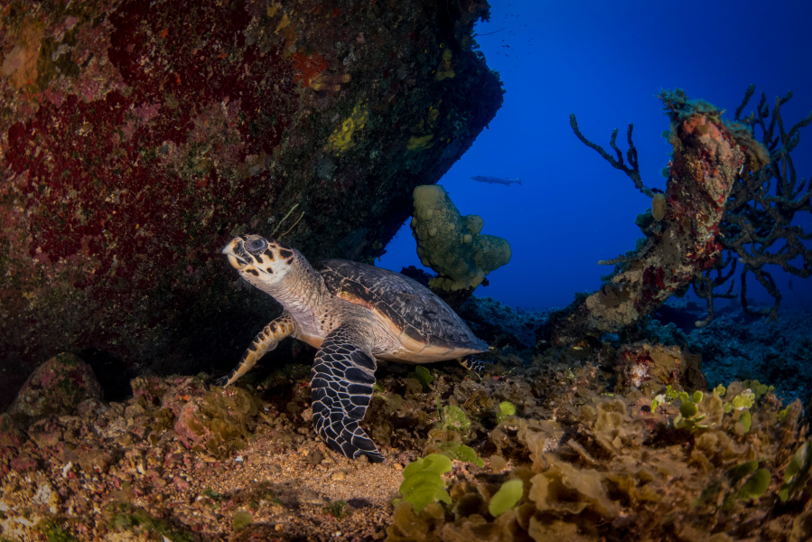
Aside from the passionate wreck divers, other folks on board simply subscribed to the philosophy that ‘wrecks are just wrecks, show me the fish!’. Fortunately, this dive also delivered the goods for them, and they were ecstatic watching the huge looming barracudas, the big schools of jacks, the many inquisitive snappers, a couple of nonchalant turtles, and a sleeping nurse shark. It seemed that the fishes’ lack of experience with divers not only enhanced their curiosity but also meant they showed a complete lack of fear. We all enjoyed getting up close and personal with marine life – especially the photographers!

For true fish fanatics, the biggest quarry of all was the elusive Sargassum Triggerfish; native only to deep seamounts such as this, and generally not seen anywhere else in Cayman. This little blue fish was the prime focus for a few of the divers on the trip. For the dedicated fish lover – a trip to 12-mile bank is essential to see one of these shy critters and complete your ‘Cayman Fish Log.’ Only then can you claim to have truly seen them all!
After a wildly successful second dive, each boat headed back home along the opposite coast. For those tackling the south side for their third dive, everyone was blown away by the stunning underwater scenery during a drift dive along a section of the island where steep cliffs prohibit any form of shore diving. It was amazing to cruise over pristine soft coral beds, under overhanging rock walls, swim through shadowy caverns, snake around huge coral heads covered in staghorn and elkhorn formations, and to hunt for stingrays in vast areas of pure white sand.
Those on the north side were treated to the dense gardens of soft corals, vast arrays of all kinds of sponges, abundant and varied marine life, and the incredible visibility that the characterises this isolated length of the north wall. Again, this third dive was made even more special in the fact that it was conducted as a one-way dive. Even in the absence of current, swimming in one direction along the beautiful reefs with no requirement to turn around meant a constantly changing and evolving landscape with no doubling back on yourself and seeing the same thing twice. Regardless of which way they went, the divers really felt that they were going ‘off-piste’ and it added a unique element to an already special day.